Administration
District Collector & Magistrate
The district's chief administrator — responsible for law and order, land revenue, disaster response, elections and the roll-out of state and central government schemes across the district.
Janjgir-Champa sits on the Mahanadi plain in the middle of Chhattisgarh, which is why it …
02Like every Indian district, Janjgir-Champa is run by a revenue administration headed by a…
03The government departments that operate offices and schemes in the district.
04The present-day district (after the 2022 formation of Sakti district) is organised into t…
05Almost every notable heritage site in the district sits by a river — a reflection of how …
06Life in Janjgir-Champa moves with the farming calendar and the river festival calendar — …
07Agriculture remains the base of the district's economy, but the last two decades have add…
08A quick look at the towns that anchor each part of Janjgir-Champa.
09Photographs of the district. Upload images from Admin → Pages → Gallery → Items.
10चांपा शहर में स्थित मां सम्लेश्वरी देवी का मंदिर जिले के जमींदार परिवार द्वारा स्थापित कि…
Janjgir-Champa sits on the Mahanadi plain in the middle of Chhattisgarh, which is why it is popularly called the "Heart of Chhattisgarh." It was created on 25 May 1998 when it was separated from Bilaspur district, and its own eastern half was later separated again in 2022 to form Sakti district.
The headquarters town, Janjgir, traces its name to Maharaja Jajwalya Dev of the Kalachuri (Kulchuri) dynasty, whose 12th-century Vishnu temple still stands near Bhima Talab in the old town. Champa, nine kilometres away, is remembered locally as being named after Champak, a horse belonging to Raja Veer Bahadur.
The district is drained by the Mahanadi and its tributaries, which is why so much of its identity — its temples, its fairs, its fertile paddy fields — sits along riverbanks. It lies on the Howrah–Mumbai railway line, and Champa Junction is one of the busier stations on that route.
Like every Indian district, Janjgir-Champa is run by a revenue administration headed by a Collector, alongside a police setup and a panchayati raj structure for rural local government.
The district's chief administrator — responsible for law and order, land revenue, disaster response, elections and the roll-out of state and central government schemes across the district.
Heads the district police force and works alongside the Collector on law-and-order matters, reporting through the Bilaspur police range.
Each subdivision — Janjgir, Champa and Pamgarh — has its own SDM handling revenue and magisterial work for the tehsils under it.
Tehsildars manage land records and revenue at the tehsil level, while elected Janpad and Gram Panchayats handle local rural governance and development works.
The Zila Panchayat oversees rural development district-wide; the Nagar Palika Parishads of Janjgir, Champa, Akaltara, Naila-Janjgir and other towns govern urban areas.
The government departments that operate offices and schemes in the district.
The present-day district (after the 2022 formation of Sakti district) is organised into three subdivisions and nine tehsils, spread across the Mahanadi's alluvial plain.
| Janjgir | Nawagarh, Akaltara, Baloda |
| Champa | Bamhnidih |
| Pamgarh | Pamgarh |
| Janjgir | District headquarters, Vishnu Mandir (Nakta Mandir) |
| Champa | Rail junction, handloom & textile training institute |
| Akaltara | Cement & power industry, birthplace of Thakur Chhedi Lal |
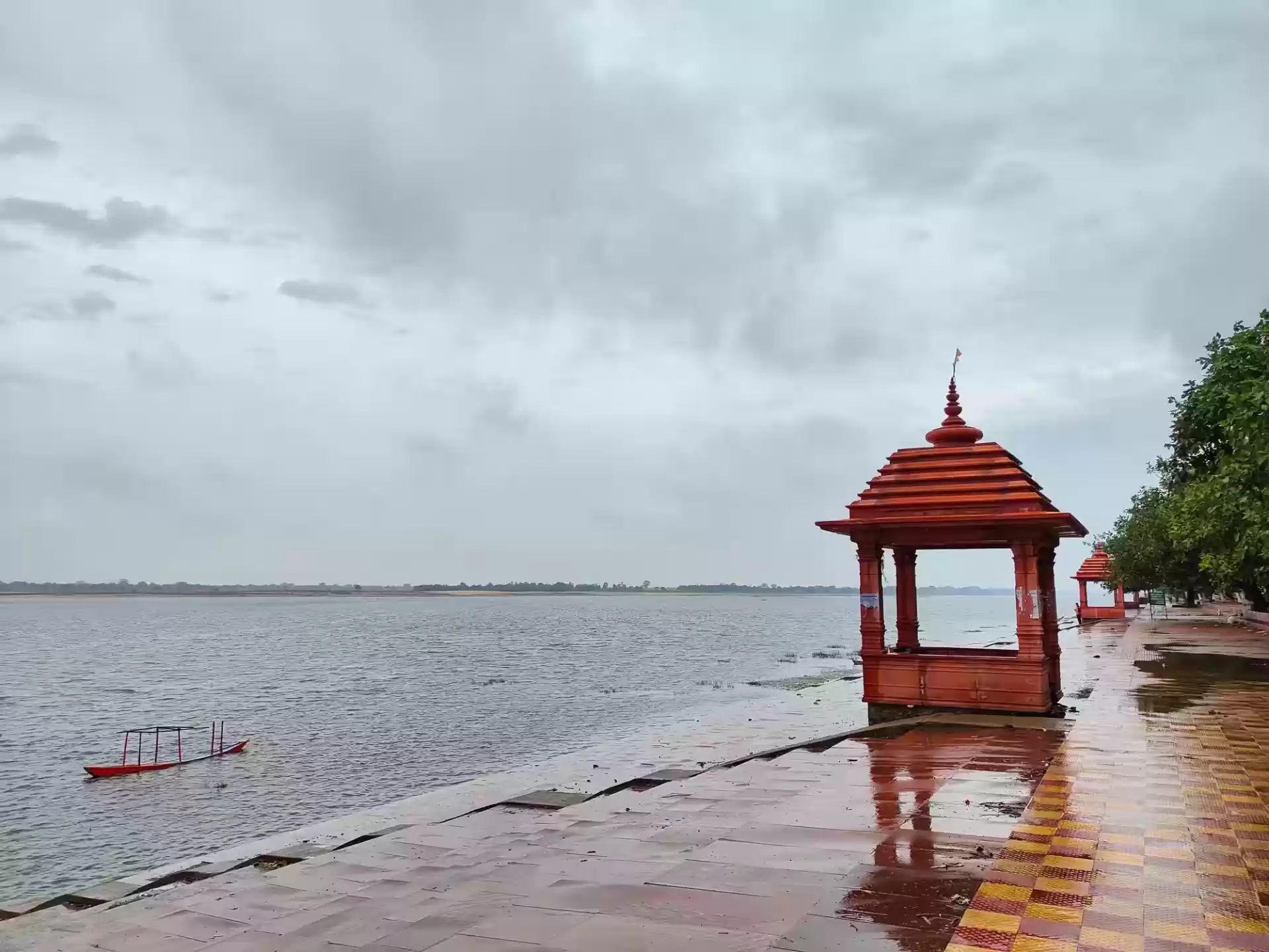
Almost every notable heritage site in the district sits by a river — a reflection of how settlement here has always followed the Mahanadi and its tributaries.
Built during the Kalachuri period near Bhima Talab in Janjgir's old town, this Vishnu temple was raised in two separate phases that were never finished together — locally it's known as the "Nakta Mandir," the unfinished temple. Its sculpted panels of deities, gandharvas and kinnaras are still its main draw.
Standing at the Triveni Sangam — the meeting point of the Mahanadi, Shivnath and Jonk rivers — this temple is linked in local tradition to Shabari's ashram from the Ramayana. It hosts one of Chhattisgarh's largest fairs, the Shivrinarayan Mela, on Maghi Purnima.
A Shiva temple on the banks of the Hasdeo river, best known for its ten-day Shiv-Vivah (divine wedding) celebrations around Maha Shivaratri, when Naga sadhus and pilgrims from across the region gather.
An old eight-armed-goddess (Ashtbhuji) shrine in the district's east — one of several local Devi temples that draw village-level pilgrimage alongside the larger riverside sites.
A picnic spot at a river confluence a short drive from Janjgir, along with the Kanhara and Damudhara waterfalls — the district's answer to a day out in nature.
A quieter, more recent addition to the district's attractions: a park built around a wetland crocodile habitat, blending conservation with a low-key tourist stop.
Life in Janjgir-Champa moves with the farming calendar and the river festival calendar — Chhattisgarhi in language and custom, and strongly shaped by the district's Vaishnav and Shaiva pilgrimage sites.
Held on the full moon of Magh at the Triveni Sangam, this is one of the largest fairs in Chhattisgarh, drawing traders, pilgrims and performers to Shivrinarayan for several days.
A ten-day observance around the Kaleshwarnath temple re-enacting Shiva's wedding, with an unusually strong presence of wandering Naga sadhus during the festival window.
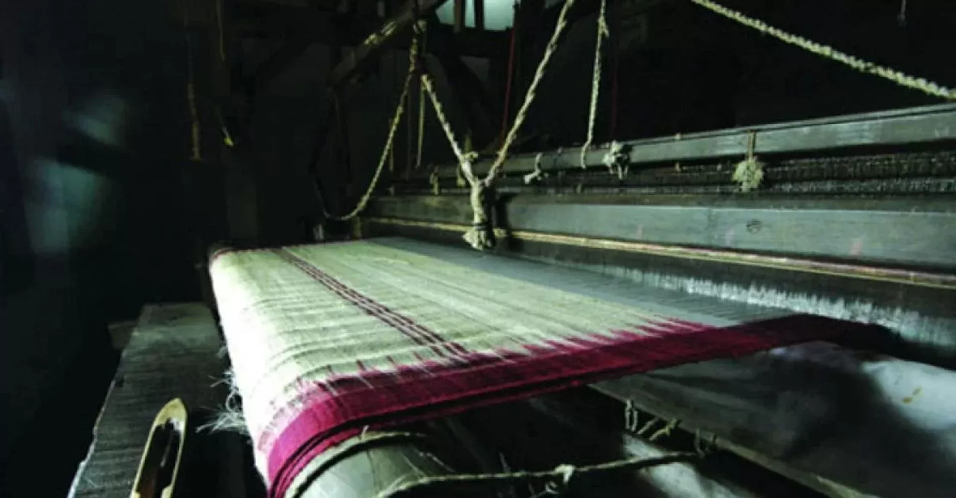
Champa is a major tussar-silk (kosa) production hub, with weavers producing for both export and local markets: home furnishings, dress materials, carpets and throws for export, and kosa silk sarees and dupattas locally. The town is also home to the Indian Institute of Handloom and Textile Technology, and weaving remains a household trade in many surrounding villages.
Beyond the well-known temples, most villages maintain their own local deity shrines and observances — a pattern typical of rural Chhattisgarh's blended folk and Vaishnav-Shaiva traditions.
Chhattisgarhi is the everyday spoken language across the district's towns and villages, with Hindi used in administration, schooling and formal settings.
Agriculture remains the base of the district's economy, but the last two decades have added a second identity: Janjgir-Champa is now one of the most power-plant-dense districts in Chhattisgarh.
The Mahanadi's alluvial plain makes this one of the state's strongest paddy-growing districts, with rice as the dominant crop alongside pulses and oilseeds — earning the district its long-standing reputation as a food-grain producer for Chhattisgarh.
Large thermal power stations at Akaltara, Marwa and Baradarha, developed by both state and private generators, have turned the district into a significant contributor to Chhattisgarh's electricity grid.
Cement plants around Akaltara, rice mills across the plain, and Champa's tussar-silk (kosa) cluster round out an economy that spans heavy industry and household craft.
A quick look at the towns that anchor each part of Janjgir-Champa.
The district headquarters, on the Howrah–Mumbai rail line via Janjgir-Naila station. Home to the 12th-century Vishnu Mandir near Bhima Talab, and connected to Raipur by NH-200.
Nine kilometres from Janjgir, Champa is a category-A railway junction and a tussar-silk (kosa) production hub. It's also home to the Indian Institute of Handloom and Textile Technology.
Sitting between Bilaspur and Janjgir, Akaltara is known for limestone, cement plants and large thermal power projects, and is the birthplace of freedom fighter Thakur Chhedi Lal.
A small town at the Triveni Sangam of the Mahanadi, Shivnath and Jonk rivers, built around the 11th-century Laxminarayan Temple and its Maghi Purnima fair.
Headquarters of the eastern Pamgarh subdivision, serving the surrounding agricultural blocks of that part of the district.
Two of the district's rural tehsils under Janjgir subdivision, both squarely within the Mahanadi plain's rice-growing belt.
चांपा शहर में स्थित मां सम्लेश्वरी देवी का मंदिर जिले के जमींदार परिवार द्वारा स्थापित किया गया था और इसकी महिमा आज भी अपरंपार है. खासकर दांपत्य जीवन में प्रावेश करने से पहले हर जोड़ा यहां आकर नतमस्तक होता है और देवी से आशीर्वाद लेता है. यह मंदिर न केवल धार्मिक आस्था का केंद्र है, बल्कि इसके इतिहास में भी एक रोचक कहानी छिपी हुई है. श्रद्धालुओं का मानना है कि मां समलेश्वरी की कृपा से वैवाहिक जीवन में सुख, समृद्धि और स्थिरता आती है. इसी विश्वास के कारण दूर-दूर से लोग यहां दर्शन के लिए पहुंचते हैं. मान्यता है कि मां सम्लेश्वरी की कृपा से वैवाहिक जीवन में सुख, समृद्धि और स्थिरता आती है. इसलिए दांपत्य जीवन में प्रवेश करने से पहले हर जोड़ा यहां आकर नतमस्तक होता है और मां से आशीर्वाद प्राप्त करता है.